Los Corales: the beach village a rulebook drew, and the plan now redrawing it
What the name actually covers
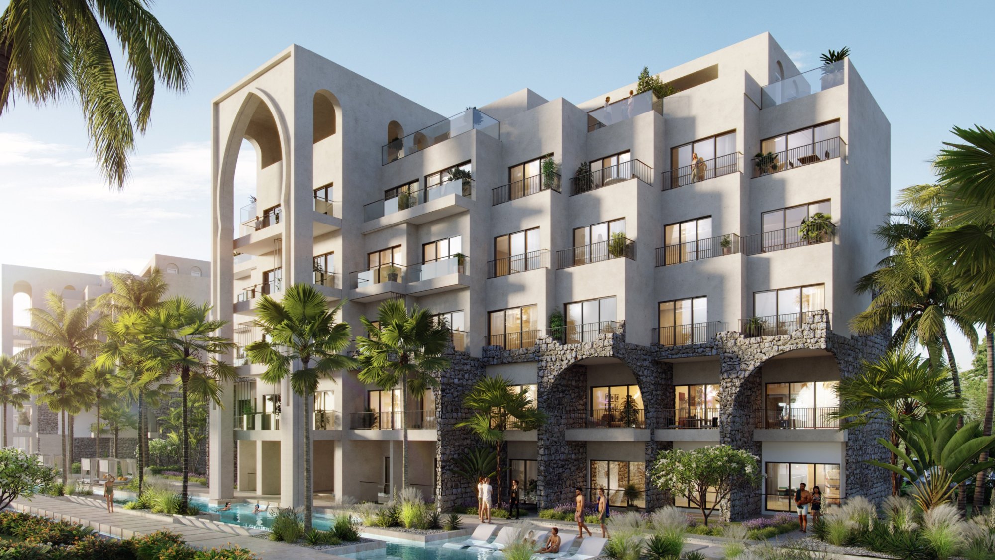
Los Corales is a neighbourhood of Bávaro, not a resort and not a single property. The name refers to the coral reef that runs along the Bávaro coastline and breaks the ocean swell well before it reaches the sand, which is why the water off its beach is usually calm. Behind that beach the neighbourhood is open rather than gated: streets of condominiums, villas and small hotels, most of them three or four storeys, with footpaths and shops close enough that a good deal of daily life happens on foot.
No authority publishes where Los Corales begins or ends, and in local use its edges blur into the neighbouring stretches of Bávaro. So the only honest distance is geometric: from Poseidonia's published coordinates to the point OpenStreetMap marks as the Los Corales neighbourhood is roughly 5 miles in a straight line. That is not a drive time, and this development's own published distances — the beach about 5 minutes away, downtown about 17 — do not include it.
When the phrase turns up as the name of a rental complex, it is a trading name. This page names none of them and reviews none of them; it looks at the place they are named after.
A village drawn by a 2005 rulebook
On 12 September 2005 the tourism ministry — then called the Secretaría de Estado de Turismo — issued Resolution 154/2005, a set of building rules for the whole tourist coast from Uvero Alto down to Punta Cana airport. The ministry's planning directorate still publishes it. Its height rule is short: buildings may rise between 2 and 4 levels above natural ground, the exact cap depending on where the project sits. Within a band of about 656 feet either side of the axis of the Boulevard Turístico, the cap is 2 levels.
Read against that rule, the look of Los Corales stops being a matter of taste. A neighbourhood of three- and four-storey buildings is a neighbourhood built up to its ceiling, not one that simply chose to stay small. The same resolution asks every project on this coast for an environmental impact study and a management plan, and asks that buildings go up without compromising the landscape that characterises the area. That is language rather than numbers, but it helps explain why this coast reads as low-rise from the water.
One caution belongs next to all of this. A resolution is a rulebook, not a map of any particular lot, and we have not checked whether individual zones have been amended since. Whether a specific parcel is capped at 2 levels or at 4 is a question for an attorney or the district council, not for a guide.
Density: why one stretch of coast feels busier than the next
Height is only half of the rulebook. The other half is density, and here the 2005 resolution treats the shore as a series of stretches between named headlands, each with its own ceiling. Converted to an acre basis, it allows about 10 rooms per acre from Uvero Alto to Punta Macao, 12 from Punta Macao to Punta Arena Gorda, 16 from Punta Arena Gorda to Punta El Cortecito, 28 from Punta El Cortecito to Punta de Los Nidos, and 12 again from there to the airport. Inland of the Boulevard the figure is about 30, and in the support towns that house many of the people who work on the coast it is about 61.
Put the two rules together and the character of the villages around El Cortecito makes sense. Where towers are ruled out, a higher density ceiling can only be spent one way: on many modest buildings standing close together. That produces streets rather than grounds, neighbours rather than setbacks, and the small-scale commercial life that makes Los Corales walkable. Where the ceiling is lower, the same height limit produces the opposite — large plots, generous gardens, and resorts or gated communities with room between their buildings.
The stretches are defined by headlands and road markers on the Boulevard, not on a published map we have been able to read, so this page does not place Los Corales, or Poseidonia, inside any one of them. The pattern along the coast is the point, not the line.
The plan being written now
That 2005 rulebook is about to get a successor. On 16 July 2026 the Ministry of the Presidency and the board of the Verón–Punta Cana tourist municipal district presented the technical document of a territorial land-use plan for the district, drawn up under Law 368-22 on territorial planning, land use and human settlements, promulgated on 22 December 2022. The plan covers about 187 square miles and divides them into seven territorial planning units, each with its own ceilings for density, height and the share of a lot that may be built on. It would place 55% of the district, about 102 square miles, under a special protection regime for farmland, forest, the coast and other sensitive ground.
For its Bávaro unit, the technical document is reported to allow up to 4 levels plus a roof terrace, about 56 feet, with up to 50% of a lot built on. If that survives consultation, the low-rise character the Bávaro coast already has would be carried forward rather than opened up to towers. The draft also proposes the district's first formal network of cycle lanes, continuous accessible pavements and safe crossings, with protected strips along the Boulevard Frank Rainieri and the Verón–Bávaro ring road set aside for footpaths and cycle lanes.
None of this is in force yet. On 11 September 2026 the Minister of Tourism described the plan as almost ready for public consultation, and acknowledged that ordering a destination that grew this fast means working against many competing interests. Treat every figure in this section as a proposal that can still change.
Reading a coastal neighbourhood the way a planner would
For anyone buying on this coast, the lesson of Los Corales is that the rules around a home shape it as much as the home itself. The view from a balcony, the noise on the street and the character of a block ten years from now are set less by the building you buy than by what its neighbours are allowed to build. Three questions are worth asking about any address here, open or gated.
What may be built next door? In an open neighbourhood, each neighbouring lot can rise to the local height cap and fill its permitted density, so a quiet empty plot today can be a four-level building later. In a gated, master-planned community, the developer's master plan adds its own layer on top of the public rules.
Which rules apply to this parcel? The district now manages land use itself, and a building project in its territory goes through the district council's land-use consultation before anything else. That is where parcel-level answers live — not in brochures, and not in guides like this one.
What is changing? With a new district plan heading for public consultation, the ceilings that govern a street may move. Following that consultation, or asking your attorney to, is a small effort set against a long ownership.
Los Corales, seen from an address in Cana Bay
Poseidonia is a development of 1,319 residences inside gated Cana Bay, priced from $179,000, with 20+ pools, golf on site, a beach about 5 minutes away and delivery projected for 2028. Its buyers are choosing a planned community, where the layout of the ground around them was decided in one piece. Los Corales is the other way a coastal neighbourhood can form: lot by lot, inside public rules, which is exactly what gives it streets worth walking after dark. Both sit within the same tourist municipal district and under the same coastal rulebook, which is why a draft plan for Bávaro is worth reading from a gated address too.
For an owner, the practical relationship is simple. Los Corales is somewhere to spend an evening on foot among small restaurants and bars, roughly 5 miles away in a straight line: a trip by car or taxi, not a stroll. For a host, it belongs in the guest welcome note described in exactly those terms — a village worth the short ride, not a place outside the door.
And for a buyer who is still deciding, it is a good place to learn to read this coast. Walk its streets, count the storeys, notice how close the buildings stand, and then look at any address you are considering with the same eyes.
Common questions
- Is Los Corales Beach Village a resort?
- No. Los Corales is an open neighbourhood of Bávaro — streets of condominiums, villas and small hotels, mostly three or four storeys, with no gate around it. The words "Los Corales Beach Village" are also used as the trading name of individual rental complexes there, so check whether a listing means the place or one business.
- Why is it called Los Corales?
- After the coral reef that runs along the Bávaro coastline. The reef breaks the ocean swell well offshore, which is why the water near the beach at Los Corales is usually calm — a general tendency, not a promise about any particular day.
- Is there a height limit for buildings in Los Corales?
- The tourism ministry's Resolution 154/2005, which covers the coast from Uvero Alto to Punta Cana airport, caps buildings at between 2 and 4 levels depending on location, and at 2 levels within about 656 feet of the Boulevard Turístico. A district plan presented in July 2026 proposes up to 4 levels plus a roof terrace, about 56 feet, for its Bávaro unit, but it is not yet in force. For any specific lot, ask an attorney or the district council.
- Is the new Verón–Punta Cana land-use plan in force?
- Not yet. Its technical document was presented on 16 July 2026, and on 11 September 2026 the Minister of Tourism said it was almost ready for public consultation. Until it completes that process, treat its figures as proposals.
- How far is Poseidonia from Los Corales?
- Roughly 5 miles in a straight line, from Poseidonia's published coordinates to the point OpenStreetMap marks as the Los Corales neighbourhood. That is geometry, not a drive time; the distances this development publishes — about 5 minutes to the beach, 17 to downtown and 25 to the airport — do not include Los Corales.
Want the details for your own situation?
Ask about availability, layouts or the buying process, and someone from the sales team will get back to you.
Get in touch